Move your mouse over image or click to enlarge
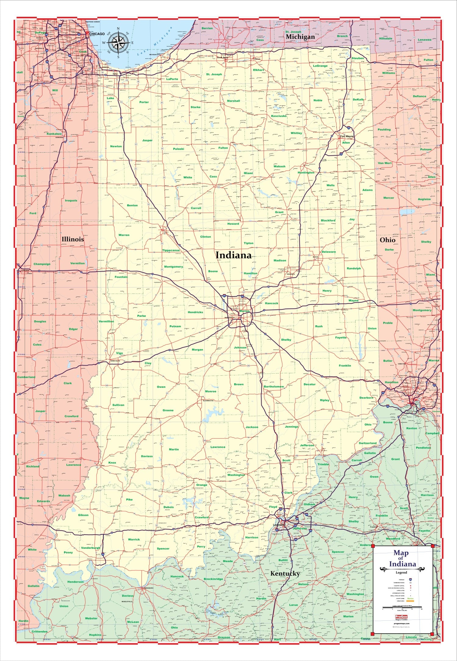
ProGeo Maps Trucker's Wall Map of INDIANA 48" X 72" LAMINATED 2018 EDITION
LARGE MAP OF INDIANA - ProGeo Maps Truckers Wall map 2018 Edition State of Indiana - Laminated on both sides with thick 3 mil plastic. This very large and easy to read map measures 48" x 72". Showing all thruways, major and secondary roads, counties, large medium, small cities and towns, this map is designed for business planning, marketing, sales and routing. The thick lamination enables the map to be writable and erasable with dry erase markers. Stickers are easily peeled off. Gorgeous pastel colors delineate Indiana and neighboring states and make it easy to read. Can be rolled up for easy transportation to planning meetings or storage. Want it customized? Send us a note.
We Also Recommend